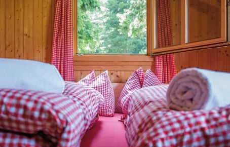
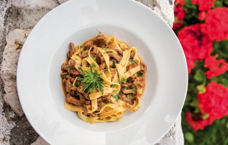
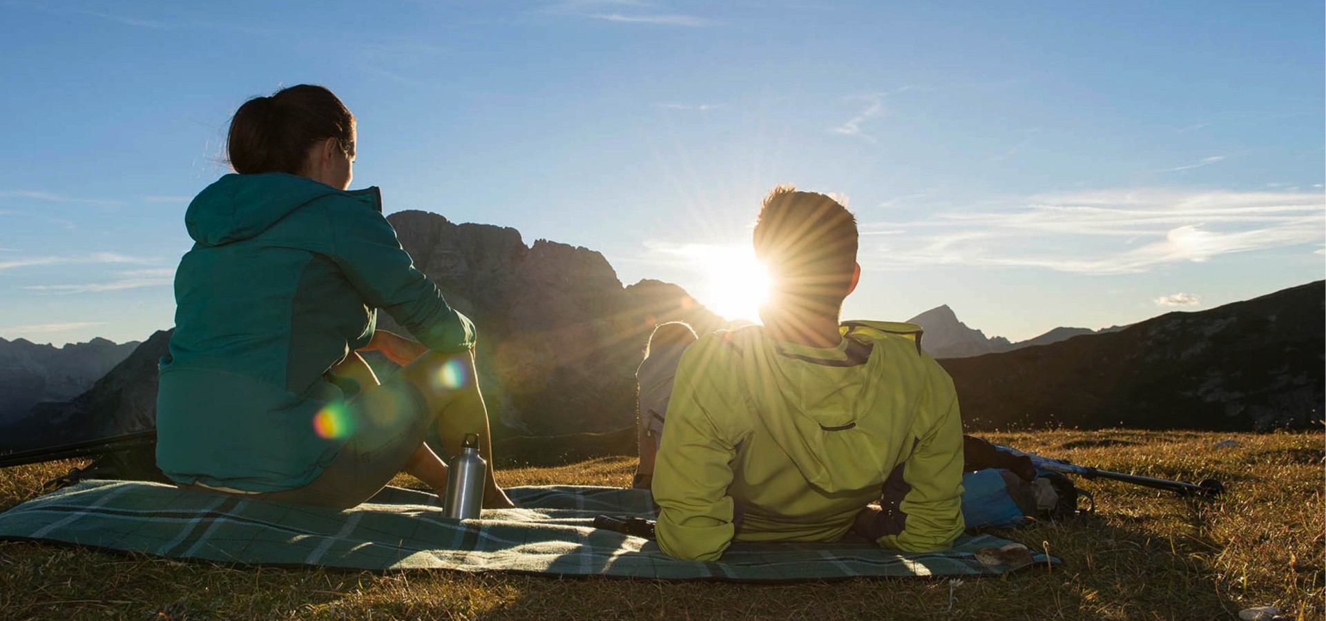
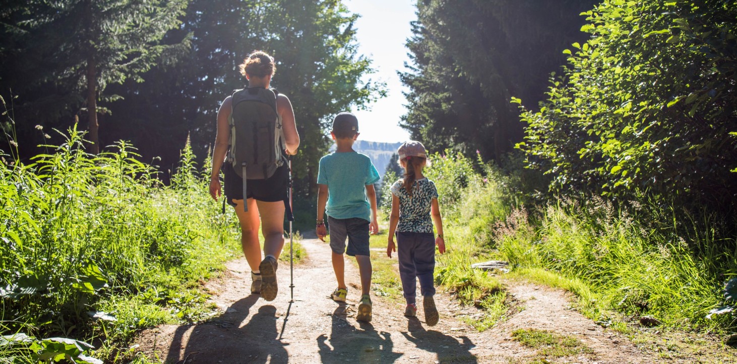
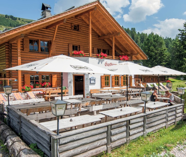
Whatever your plans in the mountains, you're in the right place with us! Hike along the magnificent Günther-Messner trail beneath the loveliest mountain summits in South Tyrol, in the Puez Geisler Nature Park, with fabulous views that on days when the weather is good stretch from the Peitlerkofel mountain all the way to Venice. Book your overnight stay here with us at the Halslhütte and start the day with a healthy and vibrant mountaineer’s breakfast. In the evening you can then enjoy a hearty evening meal in our à-la-carte restaurant which offers all kinds of dumplings, freshly picked chanterelle mushrooms and the Aferer Geisler group of mountains, which glow as the sun sets. What more could one ask for…
Dolomite hiking enjoyment!
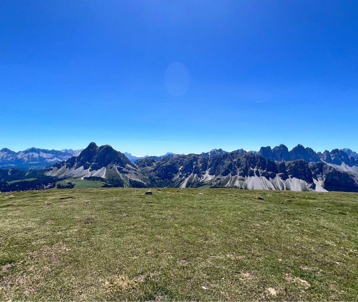
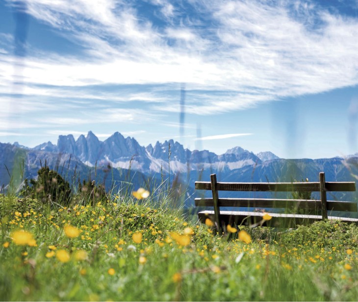
Hiking on the Würzjoch around the Peitlerkofel in the UNESCO World Heritage Site of the Dolomites!
Whatever your plans in the mountains, you're in the right place with us! Hike along the magnificent Günther-Messner trail beneath the loveliest mountain summits in South Tyrol, in the Puez Geisler Nature Park, with fabulous views that on days when...
Mountain trail Nr. 2
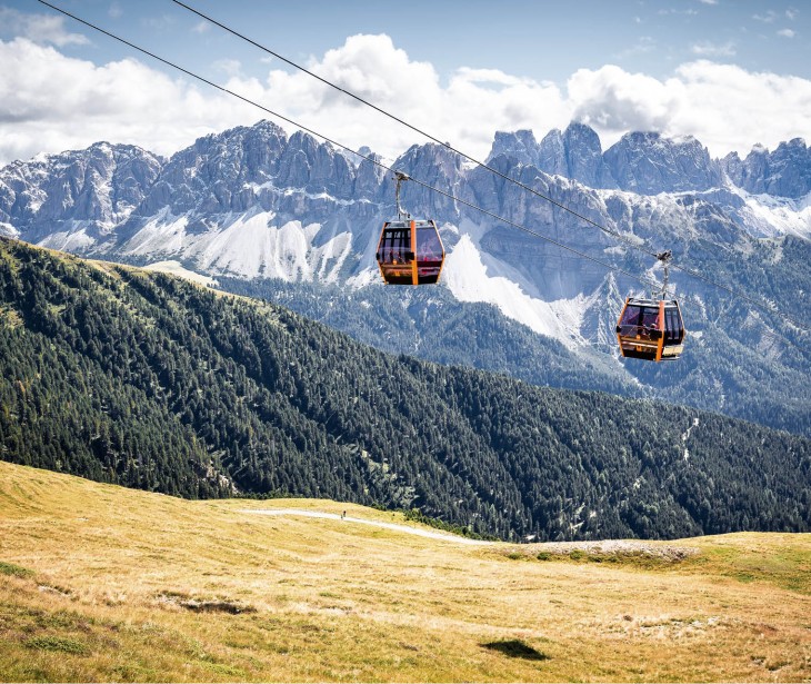
Mountain trail no. 2 in the Dolomites is one of the most beautiful and frequented paths over the Alps. 185 km long, takes 14-15 days. From Brixen, buses leave once every hour for the valley station of the Plose cable car. This cable car then takes hikers up to Plose mountain station at an altitude of 2050m. You can also climb the 1500m altitude difference from Brixen on foot. Follow path markers no. 6 or nos. 4-5. In St. Andrä, follow path marker no. 17 up to the mountain station of the cable car. Here, hikers can enjoy the wonderful panorama views over the Dolomites and can even see over to tomorrow’s destination. Halslhütte Lodge, located right next to the path, offers good accommodation for the night.
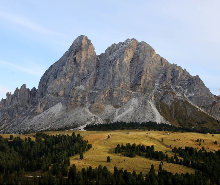
Sasso Putia
Starting from Halslhütte Lodge, proceed along the tarmacked road for approx. 1km before turning right onto path no. 4. Follow the path, first through woodland and then up over scree to Putia wind gap (Peitlerscharte/Forcella di Putia; 2357m altitude). From there, continue left along the obvious, marked path across the steep flank, following it up along serpentine curves to another wind gap between the main summit and the secondary summit (approx. 2780m altitude) and finally up a rock path with safety ropes to the summit of Sasso Putia (2874m altitude); total walking time approx. 3 hrs. Return the way you came or via Würzjoch Pass, where you can take a bus back to Halslhütte Lodge.
Circular hike around Sasso Putia
Starting from Halslhütte Lodge, drive or take a bus to Würzjoch Pass (2006m altitude). From here, follow path no. 8A as it ascends gently to a beautiful mountain pasture, always keeping the rocky face of Sasso Putia in your line of vision. Where the path forks, bear right and continue along path 8A. Follow this path all the way to Peitler wind gap. Underneath the wind gap, the path is somewhat strenuous but manageable in normal weather conditions. From Peitler wind gap (2357m above sea level, highest altitude on this walk) begin the descent (path no. 4B and path no. 35). Traverse the south flank of Sasso Putia, crossing beautiful Alpine pastures, until you reach Göma Pass (2111m altitude). From here, descend slightly again until you reach the north flank of Sasso Putia, and return to the starting point.
Gabler Mountain
The starting point for this walk is Halslhütte Lodge car park. From here, follow paths nos. 4 and 8 in the direction of Plose until you reach the fork with path no. 7A. Follow this path up to Gabler Mountain (2571m altitude, with beautiful panorama views over the Dolomites). From Gabler Mountain, proceed eastwards across the Jöcher meadows back to Halslhütte Lodge. Walking time: approx. 4 hrs.
Günther Messner Trail
Starting from the so-called Russiskreuz (“Russian Cross”) at the north foot of Aferer Geisler (1729m altitude, parking spaces available), follow the GM and 32A path markers southwards up a steep woodland path to the upper tree line, and then ascend...
Starting from the so-called Russiskreuz (“Russian Cross”) at the north foot of Aferer Geisler (1729m altitude, parking spaces available), follow the GM and 32A path markers southwards up a steep woodland path to the upper tree line, and then ascend slightly further to a spring and water trough on the west slope of Aferer Geisler (2060m altitude). It takes roughly one hour to walk along this mountain path from the Russian Cross. From the aforementioned spring, follow the GM path markers across the grassy slope until you reach a fork. Now turn left up the grassy slope and continue across until you reach another fork. Now climb the rock – along the safety ropes – to a wind gap (approx. 2600m altitude), briefly cross the north slope and ascend the exposed rock via the fixed ropes to the crest of the ridge of Aferer Geisler (small wind gap, approx. 2630m altitude). From here, descend on the easy south side to another wind gap, go down a little and then back up on the north side (often through old snow) and then ascend the south slope – the terrain here alternates between rocky and grassy – to the next wind gap; here, ascend the iron ladder. Cross the south and then the north slope to a col, then descend the grassy slope to path no. 4 and turn left up to Putia wind gap (Peitler Scharte/Forcella di Putia; 2357m altitude). This walk takes approx. 4 hours from the start of the mountain trail. Descent: From Peitler wind gap, follow path 4 through scree on the north side until the GM path forks off to the left. Follow this westwards across the entire north face of Aferer Geisler, often across scree. The last section follows the edge of the forest for some time. Descend through the forest to the Russian Cross. From Peitler wind gap, the descent takes a good two hours.
Monte Tullen
This tour begins at the Russian Cross, 1729m altitude. For this mountain hike, ascend southwards through woodland, following path 32A, until you reach a rocky crag (secured with cables). From here, ascend on the right up a grassy slope to Furtschelle Saddle and the south-west flank of the Aferer ridge. Here you can enjoy spectacular views over the Geisler mountains. Now bear left and follow the GM (Günther Messner Trail) path markers north east up the pastured slopes of Kofelalm until you reach the Monte Tullen cirque. Continue left along a serpentine path to the wind gap and the eastern ridge (sturdy footwear required) to the summit of Monte Tullen (2653m altitude). Descend along the same route.
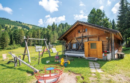
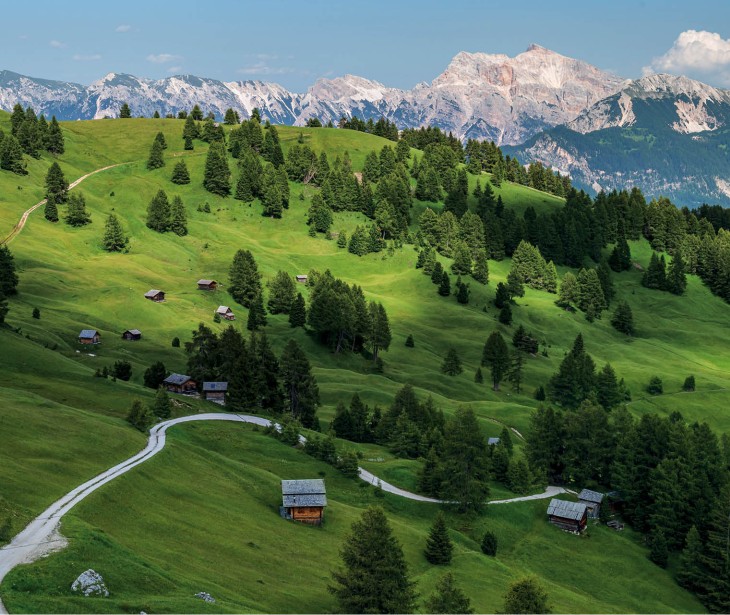
The Swiss stone pine trail
The Swiss stone pine trail begins by the lime kiln in Hinterlüsen Valley (1710m altitude). This former lime kiln has been restored in memory of the time when lime was produced in the valley. Follow the broad course of Lasanken stream – which was once filled with Dolomite rock – past Gunggan to the Piscoier meadows. From here, continue to Halslhütte Lodge (open for refreshments) and then ascend to Enzian Lodge (closed) or Schatzer Lodge. On the return journey along the cart path, hikers can linger and enjoy the beguiling fragrance of the Swiss stone pines. Pass the Runggatscher meadows and return to the lime kiln.
Around Halsl
Follow path no. 4 from Halslhütte Lodge up to Enzian Lodge (no longer open). From here, follow the level path eastwards, enjoying fantastic views over Aferer Geisler and Sasso Putia. When you reach Drockeralm, ascend along path no. 9, following path no. 9A for the final stretch to Gunggan trenches. From here, path no. 8 leads you back to Halslhütte Lodge.
Pfannspitz
The starting point for this walk is Halslhütte Lodge in Villnöss. Follow path no. 4 in a north-east direction, in the pine forest to the Gampen meadows (2008m altitude). From here, ascend on the right across the steep slope of Gabler Mountain to the trenches, and continue on to the lift. Go up to the mountain station of the Pfannspitz chair lift and then bear north-east over the ridge (path markers no. 7) to the summit of Große Pfannspitz (2545m altitude). Return to the Lüsen wind gap and follow path marker no. 6 down to Rossalm (2200m altitude). Follow path 17A back to the trenches and ascend back along the mountain trail (path marker no. 4) to the starting point.
Alpine roses
This delightful circular walk begins in Lüsen . Follow the forest path through Huben Woods in the direction of Nivenol. From here, bear right and continue past the Brandweinbrünnl (lit. brandy spring) to Ackerboden (arable land). Follow the no. 6...
This delightful circular walk begins in Lüsen. Follow the forest path through Huben Woods in the direction of Nivenol. From here, bear right and continue past the Brandweinbrünnl (lit. brandy spring) to Ackerboden (arable land). Follow the no. 6 path markers on to Ochsenalm, where the beautiful Brixen mountain trail begins. This gently undulating path, which ranges from easy to moderate, leads you to Kreuztal. From here, follow the panorama trail on to Halslhütte Lodge and then continue along path no. 8 to the Piscoier meadows and down to the lime kiln hut. Cross Hinterlüsen Valley to return to the starting point.